Iowans are warned to prep for foul weather ahead
JOHNSTON — Today marks the start of Severe Weather Awareness Week in Iowa, as residents are reminded about some of the hazards that may be coming in the weeks and months ahead.
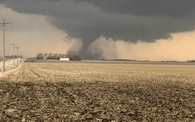
National Weather Service meteorologist Chad Hahn says tornadoes are one of the worst risks to lives and property, and last year, we had plenty. “In Iowa, we had 43 tornadoes observed across the state,” Hahn says. “That’s slightly lower than our normal or average historically, which is right around 50 that we typically observe. Of course, we’ve had some years that we’ve had over 100, so there’s wide variability when it comes to the number of tornadoes.”
Each day this week, there will be a different weather focus. Today, Hahn says, they’re zeroed in on severe thunderstorms. Hahn says, “We’re talking about what requires a thunderstorm to be considered severe, which is one-inch or larger hail and/or thunderstorm wind gusts in excess of 58 miles per hour.”
Other days this week will center on things like flooding, the difference between a watch and a warning, and how best to stay informed through old-school weather radios or smartphone apps. A statewide tornado drill is scheduled for Wednesday at 10 A-M. Hahn says the weather service is opening a series of storm spotter classes starting today. “We picked about 20 spots this year, many of them that we haven’t been since before COVID, actually, physically in the location, so we’re excited to get out into the communities that we serve,” Hahn says. “I’m happy to say we’re going to be getting into a lot of the far reaches of our areas of responsibility, including Emmet County, way up in the northwest, all the way down to Taylor County in our southwest.”
Learn more at www.weather.gov/dmx.
For the latest